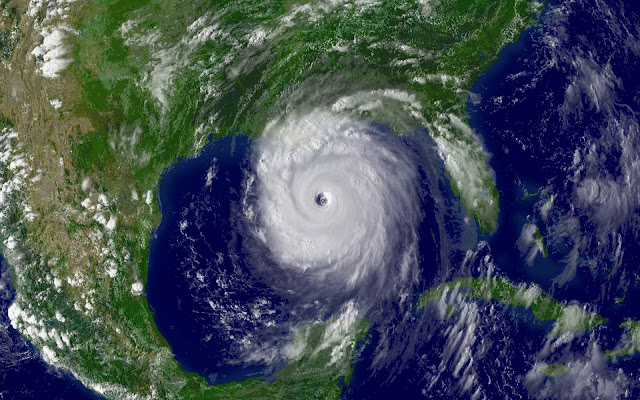
Above: The GFS computer weather forecast for May 21, 2012. Notice the red circle due south of the Florida peninsula indicating a developing tropical system. Note: These forecasts are constantly changing and very unreliable beyond a few days. Click on the link above to see the current forecast (which will be different from the representation above).
Tropical Weather for Florida?
In the Atlantic, where hurricane season officially starts on June 1, the action may be about to heat up. For the past several days, the GFS model (above) has been consistently predicting the development of a subtropical storm in the Western Caribbean, or waters near Florida, sometime May 19 - 21. The European Center model has not been on board with this, but has been predicting a very moist flow of tropical air will develop, bringing heavy rains to Florida May 19 - 20. So, it is possible we will see the Atlantic's first named storm occur in May this year. However, the computer models are very unreliable 9 days out.
Regardless, any rain that does make its way to the Florida peninsula will be greatly appreciated. The central peninsula is suffering through an exceptional, years long drought.
TROPICAL LOW FORMS NEAR THE AZORES
An interesting and surprising hybrid low pressure system with both tropical and extratropical characteristics has formed over the far Eastern Atlantic, about 400 miles southwest of the southern Azores Islands. This low, designated Invest 92L by the National Hurricane Center, has developed an impressive amount of heavy thunderstorm activity near its center, despite the fact that it is over cold ocean waters with temperatures of 66° F (19° C). This is well below the 26° C usually needed for a tropical storm to form. However, there is quite cold air aloft, so the temperature difference between the surface the upper levels has been great enough to create sufficient instability for 92L to organize. Wind shear is a moderate 15 - 20 knots, and satellite estimates of 92L's winds were 63 mph at 1:45 pm EDT Saturday, according to NOAA/NESDIS. NHC estimated that 92L had top winds of 50 mph at 2 pm EDT Saturday.
The coldest waters where a tropical storm has formed were 19° C, during Tropical Storm Grace of 2009. Grace holds the record for being the farthest northeast forming tropical cyclone in the Atlantic basin. Like 92L, Grace also formed near the Azores Islands, but in early October.
The coldest waters where a hurricane formed were 22° C, for Hurricane Epsilon of 2005. Latest guidance from the computer models show 92L meandering to the south of the Azores through Monday, then beginning a slow motion towards the northeast by Tuesday.
Meanwhile. . .
Hurricane season is coming
Hurricane season is coming
It's now mid-May, which means that hurricane season is about to start in the East Pacific. The official start of the East Pacific hurricane season is May 15, and the action is already starting to heat up. The first system of 2012 that the National Hurricane Center is also investigating—Invest 90E—is in the East Pacific.
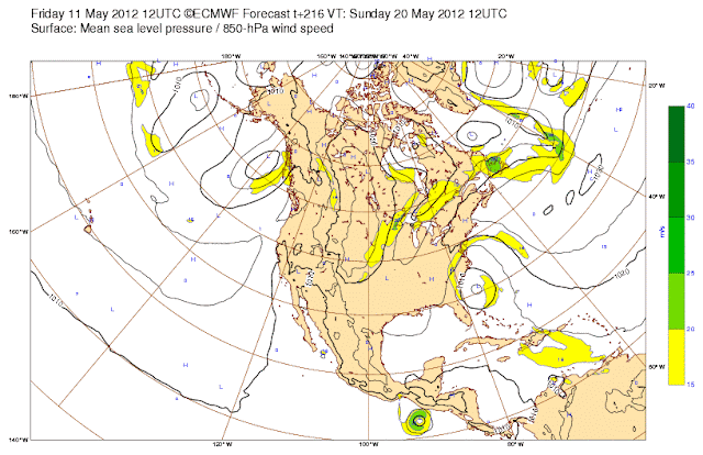
Above: The ECMWF forecast for May 20, 2012 showing a tropical storm off the coast of Mexico and a tropical disturbance forming to the northeast of Florida.
Invest 90E, is located about 700 miles south of Puerto Vallarta, Mexico, and is moving westward out to sea, posing no threat to any land areas. The ECMWF predicts the possibility of another system getting organized in the East Pacific, closer to the coast of Mexico, during the period Wednesday - Friday (May 16 - 18).


